Your Partner in Precision As-Builts

Expert 3D Laser Scanning for Las Vegas' AEC Community

We provide more than just point clouds; we deliver design-ready data and the expert architectural insights needed to streamline your project from concept to completion.

Expertise in Design, Precision for Construction

Data That Speaks Design

Founded by a licensed architect, we understand design intent. We provide data that seamlessly integrates into your BIM and CAD workflows, anticipating the needs of architects and engineers. Our scans are more than just points; they’re the foundation for informed design decisions.

Your Dedicated Local Partner

From Henderson to Summerlin, we are your on-the-ground reality capture experts. As a dedicated Las Vegas business, we provide the responsive, hands-on service that large national firms can’t match. We’re invested in the success of your local project because we’re part of the same community.

Clarity for the Field

We deliver construction-ready data that empowers general contractors and trades. Use our precise as-builts for clash detection, progress monitoring, and verifying field conditions against drawings. Reduce rework, avoid costly surprises, and keep your project on schedule with data you can build on.

A Track Record of Success

For over seven years, the team behind Vizn Spatial has been the trusted reality capture partner for leading architects, general contractors, and developers across Las Vegas. Our track record of delivering pristine data for hundreds of projects speaks for itself.

Completed Projects
0 Projects
Years of LiDAR Experience
0 +
Over 100 Satisfied Clients
0 Clients
Expert Team Members
0 +
Our Projects

Showcasing Our Work

Explore some of our completed lidar scanning projects that demonstrate our expertise in capturing detailed 3D spatial data for various infrastructure and heritage preservation needs.
BK Fort Apache Scan
Burger King | Fort Apache Road

Location: Las Vegas, NV

Description: Provided a high-density 3D laser scan and as-built documentation for a quick-service restaurant (QSR) to support a future brand remodel and facilities management. Our precise point cloud data captured all exterior features, site conditions, and MEP connections, creating a perfect digital twin for the design team.

Historic Preservation of Old Nevada Bank Building
Providing detailed terrestrial lidar scans to assist Nevada Heritage Society in restoration efforts, completed in November 2022.
Commercial Office Interior Mapping
Indoor lidar scans of ABC Commercial Realty’s office space to facilitate renovation and space planning, finalized in February 2023.

Advanced Technology for Precise 3D Spatial Data Capture

At Vizn Spatial, we leverage cutting-edge technology to deliver unparalleled precision in 3D spatial data capture. Our advanced lidar scanning equipment and software enable us to provide detailed and accurate models for various applications. We are committed to staying at the forefront of technological advancements to meet the evolving needs of our clients.

An image showing a drone equipped with lidar scanning technology flying over a construction site, capturing aerial data.
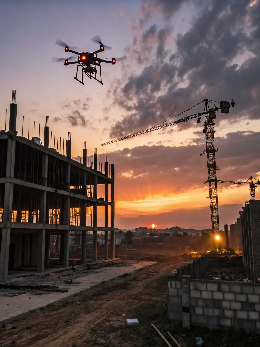
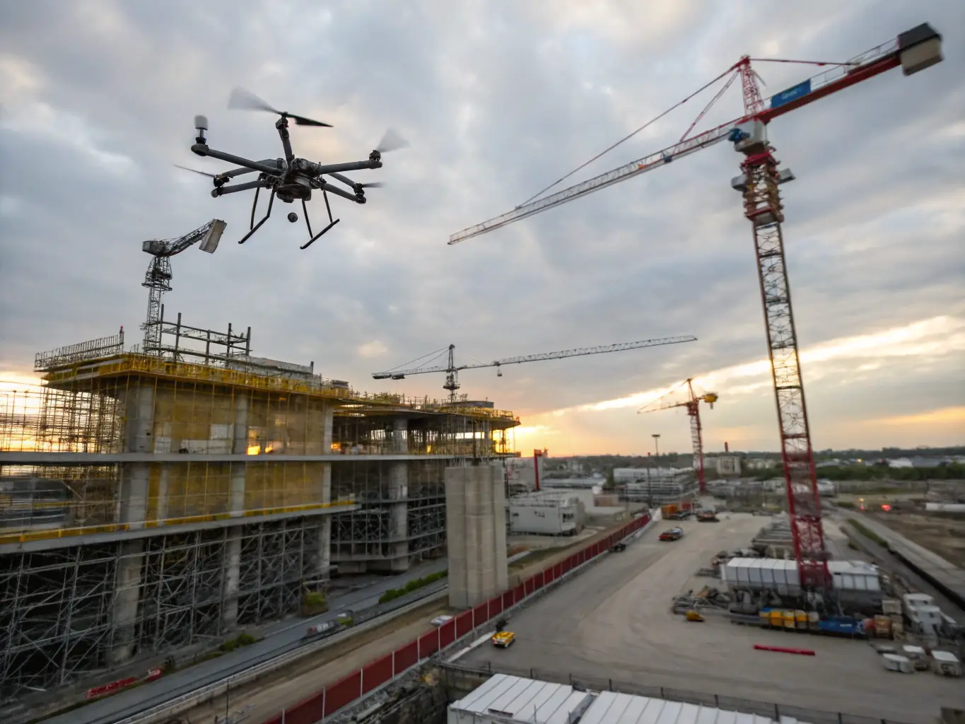
Aerial Lidar Scanning
Capture extensive areas quickly with our aerial lidar scanning. Ideal for urban planning and environmental projects, providing detailed 3D models efficiently.
An image of a technician using a terrestrial lidar scanner to capture detailed 3D data of a building's facade.
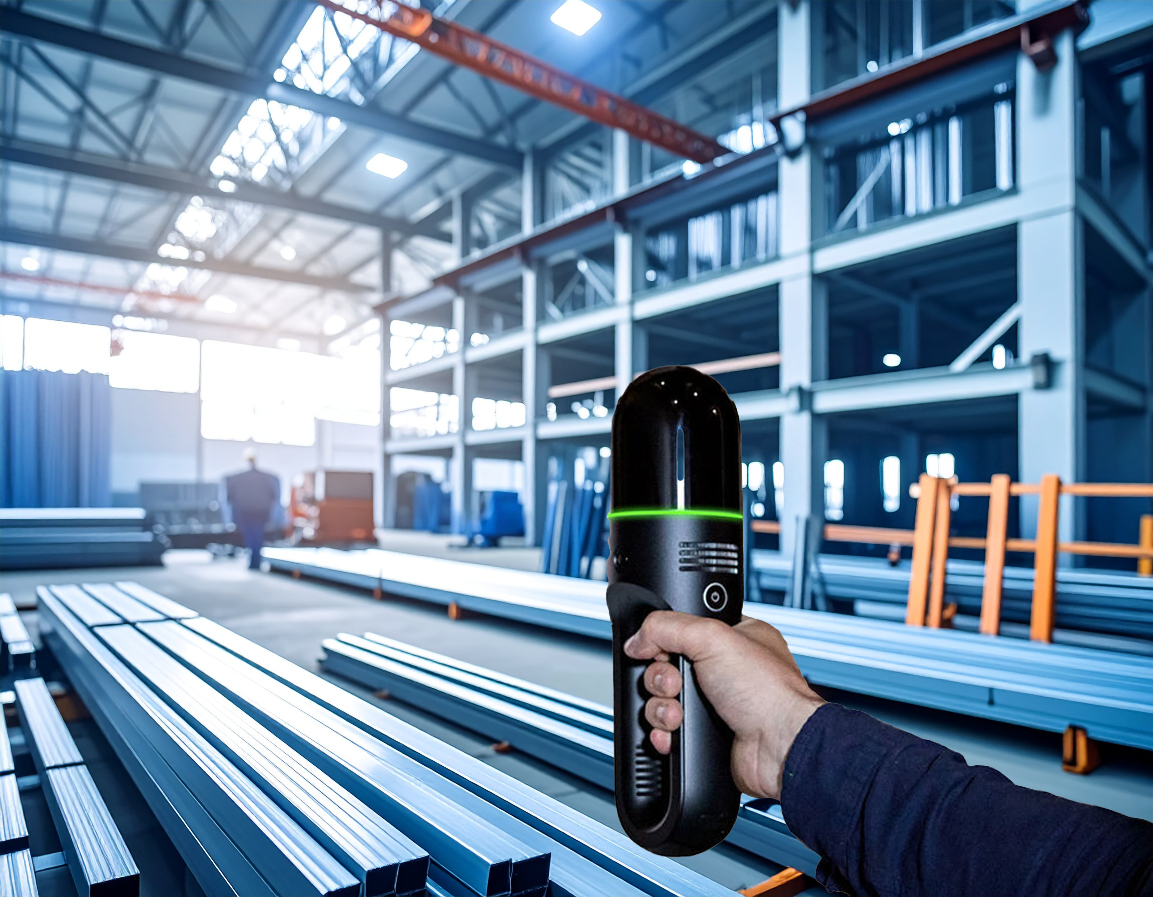
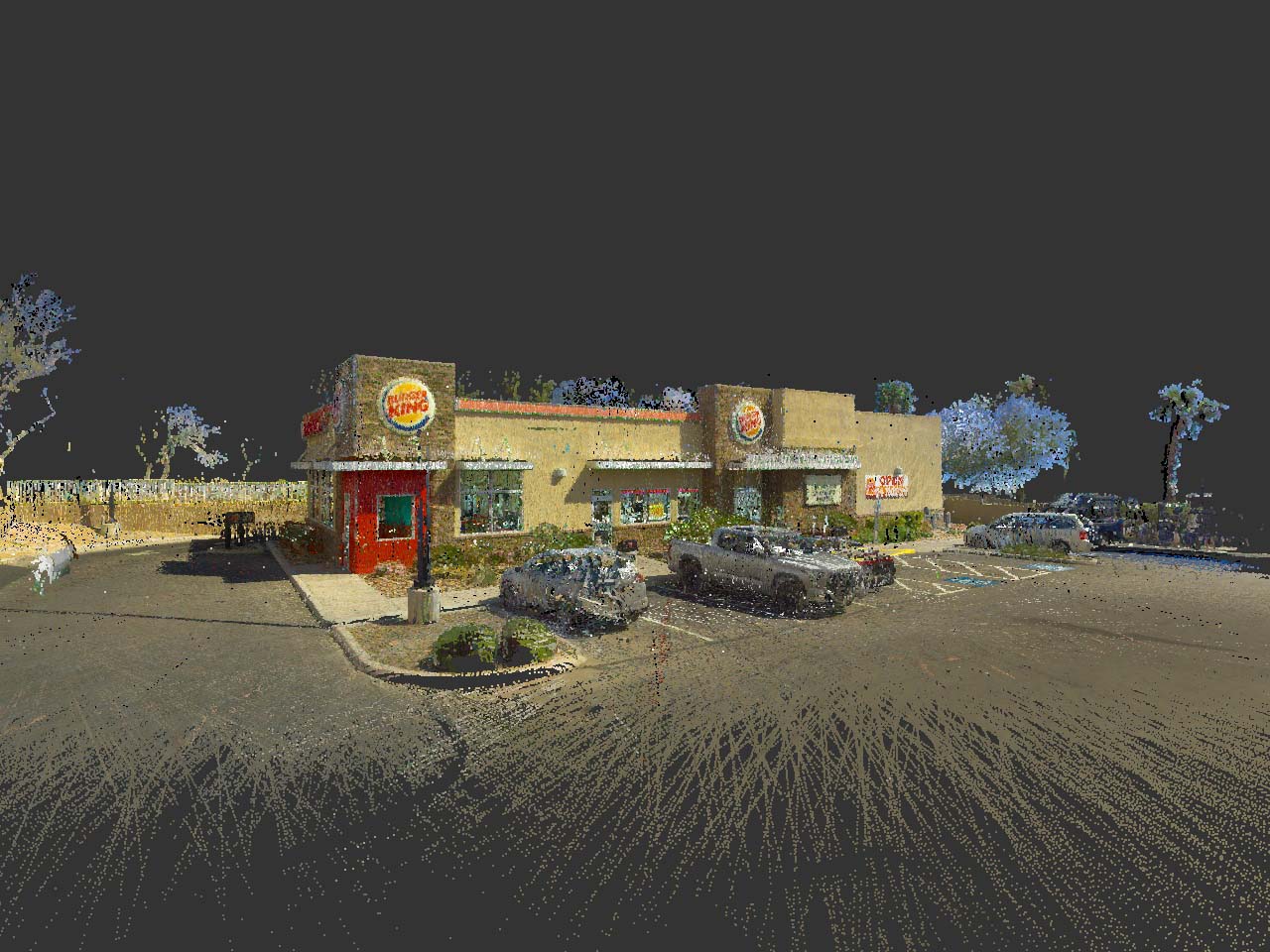
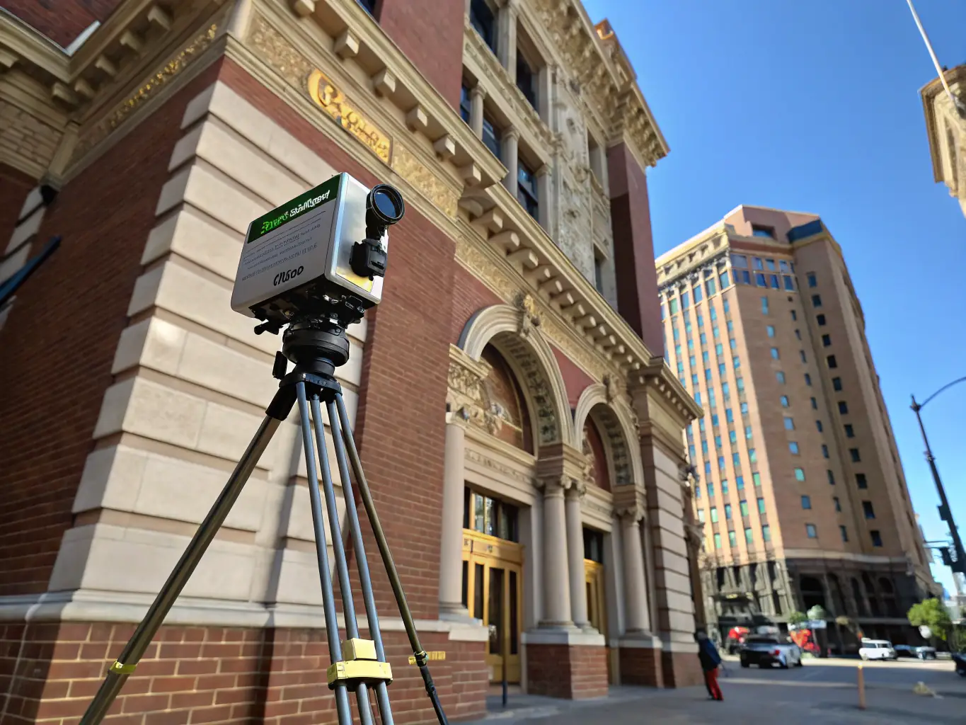
Terrestrial Lidar Scanning
Our terrestrial lidar scanning offers highly detailed 3D models of structures. Perfect for renovation projects, ensuring precise measurements and analysis for restoration.
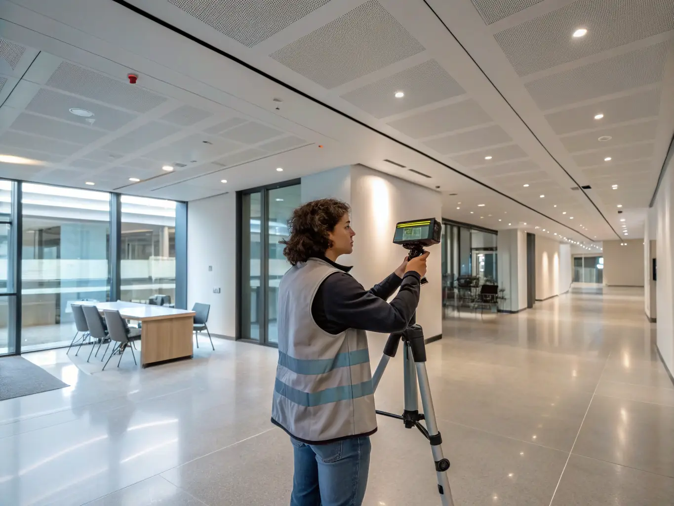
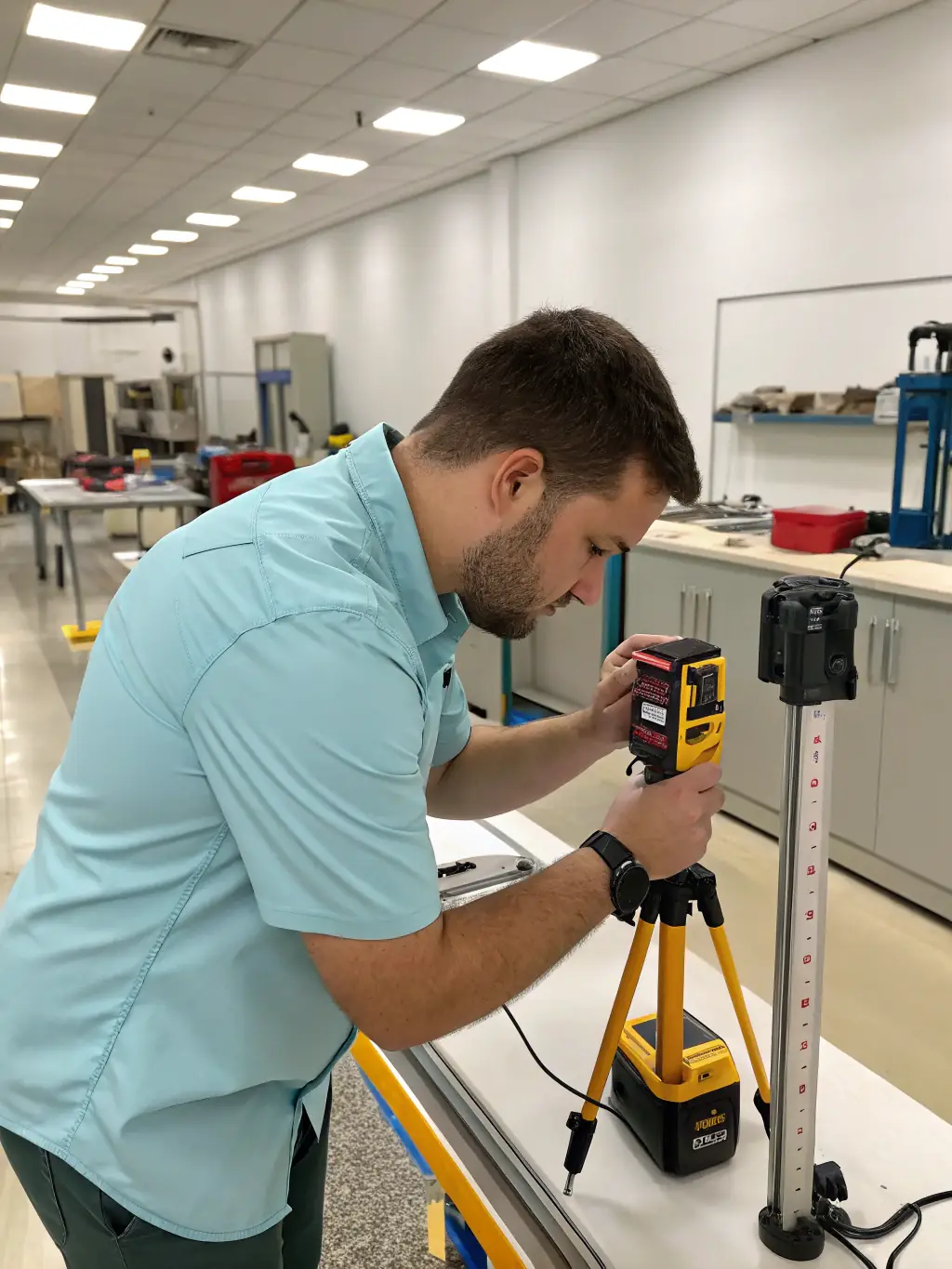
Indoor Lidar Scanning
Create detailed interior maps with our indoor lidar scanning. Enhance facility management and speed up renovation projects with accurate spatial data.
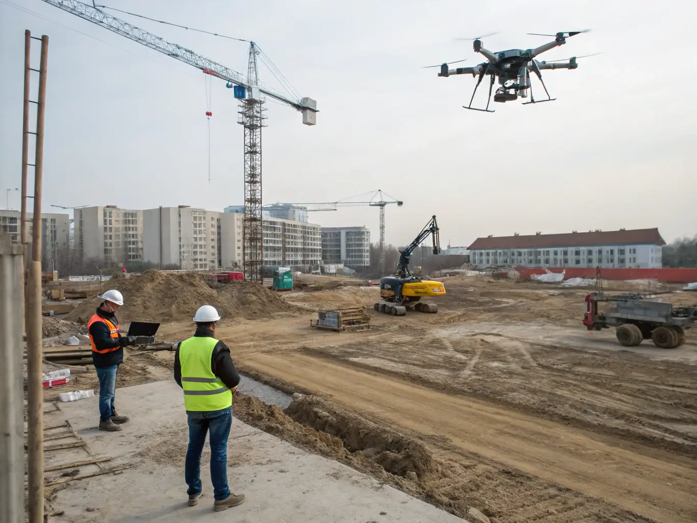
Unlock the Power of LiDAR Scanning for Your AEC Projects

Discover how Apex Spatial’s lidar scanning services can revolutionize your architecture, engineering, and construction projects. Our advanced technology provides unparalleled accuracy, efficiency, and insights, ensuring you stay ahead in today’s competitive landscape. Explore the key benefits below.
A high-resolution image showcasing a drone equipped with lidar technology scanning a large construction site, emphasizing the speed and coverage of aerial lidar scanning.
Extensive Coverage
Aerial lidar scanning provides extensive coverage of large areas quickly and accurately. It enables detailed 3D modeling of complex environments, reducing on-site survey time and costs significantly.
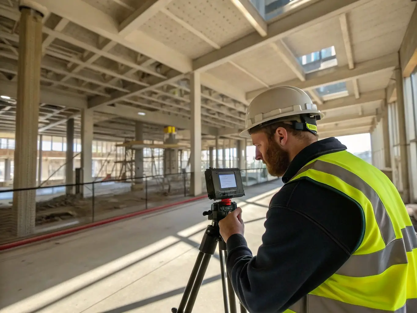
A detailed image of a technician using a terrestrial lidar scanner to capture precise data of a building's facade, highlighting the accuracy and detail of terrestrial scanning.
High Accuracy
Terrestrial lidar scanning captures highly detailed and accurate 3D data of structures. It is ideal for renovation and restoration projects, facilitating precise measurements and analysis for documentation purposes.
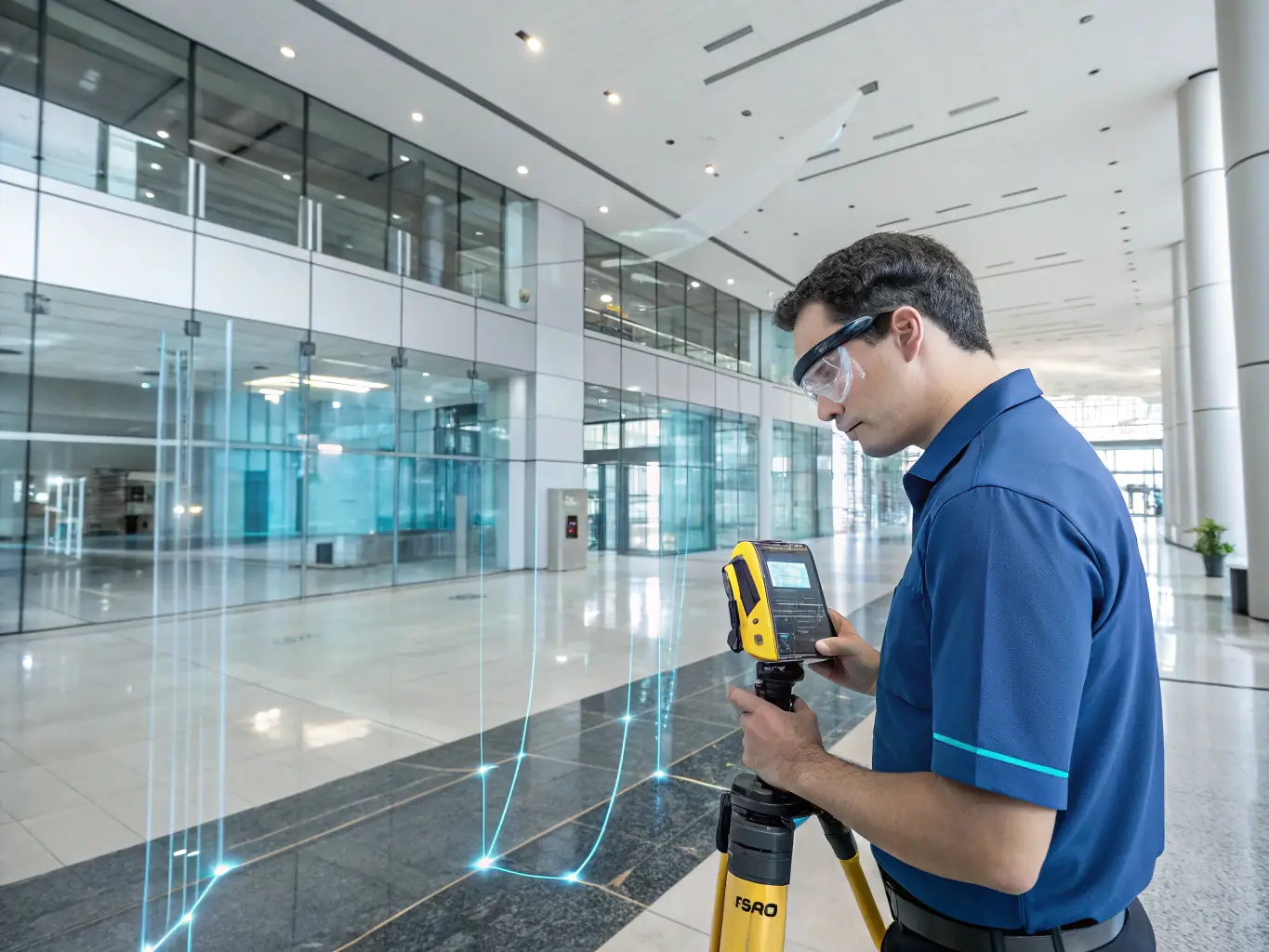
An image showing a technician using a handheld lidar scanner inside a building, capturing interior details for architectural planning and facility management.
Detailed Interiors
Indoor lidar scanning creates detailed interior maps for renovation and design. It enhances facility management with accurate spatial data, speeding up project timelines with quick data collection and supporting virtual walkthroughs.
Get in Touch

Contact Vizn Spatial

Reach out to our team for precise lidar scanning solutions tailored to your project needs.